Industries
Construction progress monitoring at 1 m, without tasking a satellite
Construction and land development teams follow any site, corridor or portfolio at 1 m from a desk: GammaEarth super-resolves free Sentinel-2 imagery from 10 m across all 10 spectral bands. Any location, any date since 2018, with new imagery every five days and no acquisition to commission.
See the difference
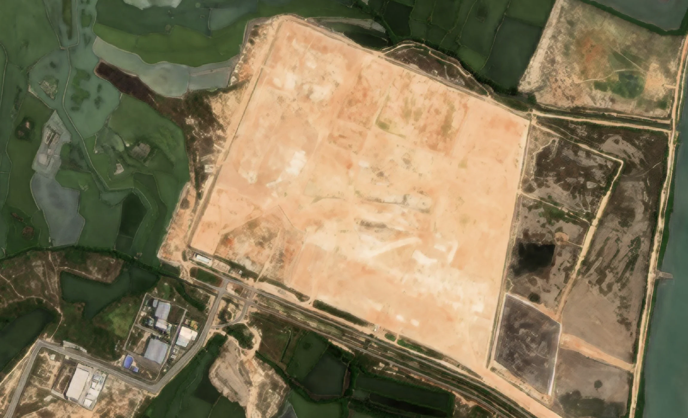
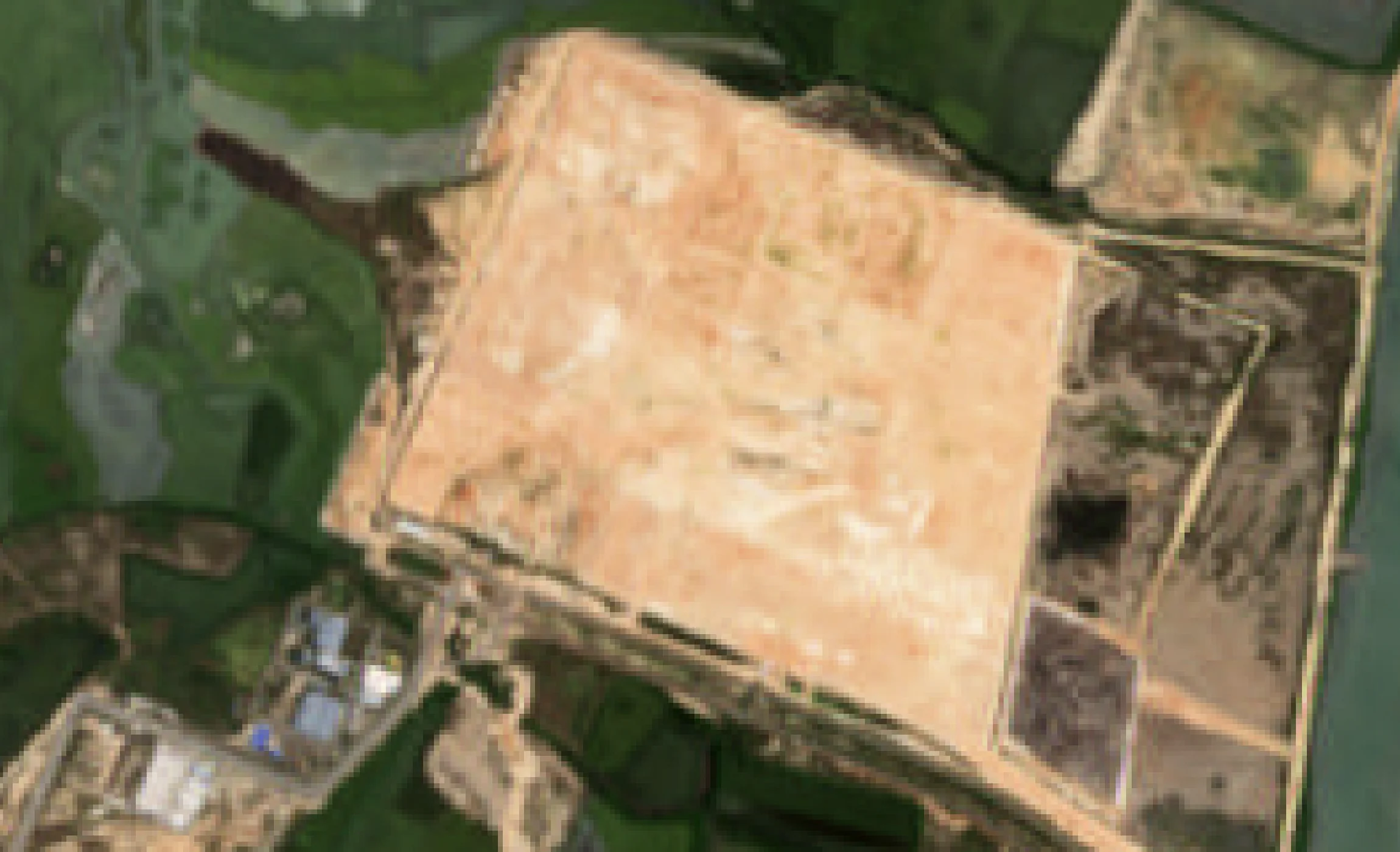
A construction site at 10 m, and the same scene at 1 m
Sentinel-2 · 10 m
S2DR3 · 1 m
Sentinel-2 true-colour imagery of a cleared construction site beside coastal fish ponds at 10 m, beside the GammaEarth S2DR3 output at 1 m, where haul roads, plot edges and individual buildings separate.
Site monitoring
Follow any site from a desk, every five days
Track changes every five days
Sentinel-2 images the whole planet every five days, and each new scene can be super-resolved from 10 m to 1 m on demand — frequent enough to follow a site week by week, from a desk.
Know site status without a visit
Construction site monitoring without a visit: each processed date is an objective record of what stood on the ground. Check status, brief stakeholders and keep an audit trail without travelling.
Analyse progress across any dates
Compare any dates since 2018: establish a baseline before work began, document milestones as they were reached, and verify reported progress against what the imagery shows.
Oversee a portfolio in one workflow
Monitor every site through the same pipeline: order the same AOIs (areas of interest) on a fixed cadence through the API or Python SDK, and receive analysis-ready GeoTIFFs.
Cost and access
You do not need a tasked-imagery budget to monitor a site
1 m resolves the work on the ground
The S2DR3 and S2DR4 models (Sentinel-2 Deep Resolution 3 and 4) rebuild free Sentinel-2 imagery at 1 m/px across all 10 spectral bands — sufficient for tracking structures appearing, earthworks advancing, laydown areas filling and clearing, and the vegetation around a development.
See the S2DR3 and S2DR4 modelsPriced for a single site
One credit processes one km² of Sentinel-2 imagery in standard regions, at €2.00 per credit — and the balance starts at 100 credits (€200), not at a portfolio-sized contract. Each processed date draws only the credits its area needs.
See pricingAny site, any date since 2018
There is nothing to commission and no acquisition window: choose an AOI and a date, and the 1 m product is processed from the Sentinel-2 scene already on record. Baselines reach back to 2018, a date is charged only when it is first processed, and retrieving it again is free.
Start in a browser, with 20 free scenes
The free tier processes 20 scenes through Google Colab, in the browser, with nothing to install — proof on your own site before any commitment. From there, the same monitoring runs through the API or Python SDK as analysis-ready GeoTIFFs.
Use cases
From a single site to a whole corridor
Construction progress monitoring
Process the same site AOI on a fixed cadence and compare the 1 m outputs date by date: structures appearing, earthworks advancing, laydown areas filling and clearing.
Land development and site assessment
Assess a parcel before committing to it: its current state at 1 m, plus its history back to 2018 — prior clearing, groundworks and neighbouring development.
Earthworks and change detection
Compare scenes across dates to locate clearing, grading and stockpile movement. Change detection at 1 m places the change on the site, not somewhere inside a 10 m pixel.
Infrastructure corridor monitoring
Process a whole corridor — road, rail or utility — as a single AOI and revisit it on the Sentinel-2 five-day cycle, at one credit per km² in standard regions.
Urban expansion mapping
Track how a city's edge moves — urban development monitoring at 1 m. New streets, rooftops and cleared parcels separate from the surrounding fabric, and the archive shows when each of them appeared.
Green space and vegetation monitoring
NDVI (normalised difference vegetation index) at 1 m shows the vegetation around a development — what was cleared, what was retained and how replanting establishes — in the same product as the imagery.
FAQ
Construction monitoring questions
Can satellite imagery track progress on a single construction site?
Yes. GammaEarth super-resolves Sentinel-2 imagery from 10 m to 1 m across all 10 spectral bands — enough to distinguish plots, access roads, stockpiles and individual structures. Process the same site AOI (area of interest) at each date and compare the outputs to follow progress.
Is super-resolved Sentinel-2 imagery good enough for construction progress monitoring?
Yes. At 1 m/px across all 10 spectral bands, structures appearing, earthworks advancing and laydown areas filling and clearing all register between dates — the observations progress monitoring runs on. That sufficiency is what makes monitoring affordable: at €2.00 per credit and one km² per credit in standard regions, checking a 10 km² site once a month for a year is 120 credits (€240).
How often can I get updated imagery of my site?
A site can be re-checked every five days: Sentinel-2 re-images the whole planet on that cycle, at no cost, and each new acquisition can be super-resolved to 1 m. In cloudy climates the S2DR4 model (Sentinel-2 Deep Resolution 4) removes cloud, haze and shadow automatically, so more of those passes produce a usable record.
Do I need to task a satellite?
No. There is nothing to commission or schedule: GammaEarth processes existing Sentinel-2 scenes. Any Sentinel-2A or Sentinel-2B scene from 2018 onwards can be super-resolved to 1 m/px, for any area of interest.
What does monitoring a construction site cost?
A site is priced by its area: one credit covers one km² in standard regions, credits cost €2.00 each, and the minimum purchase is 100 credits (€200) — so a 10 km² site and its surroundings is 10 credits (€20) per processed date, regardless of model or delivery method. Only newly processed dates consume credits; pulling a date you have already processed costs nothing, credits remain valid for 24 months, and 20 free scenes through Google Colab let you test before buying.
What formats does the site imagery arrive in?
Site imagery arrives as 16-bit GeoTIFF (COG ready — cloud-optimised GeoTIFF) at 1 m/px ground sample distance (GSD) in UTM projection: the 10-band multispectral product plus derived RGB, NDVI and IRP (infra-red pseudo-colour) composites, through the API or Python SDK. Because every file is anchored to a dated public acquisition, the same deliverables double as an audit trail for progress reports and stakeholder records.
Monitoring a site, a portfolio, or a corridor?
Tell us the areas you need to watch and the cadence you need them on. We respond within one business day.