Industries
A whole jurisdiction at 1 m, on a five-day cycle
Governments and public monitoring programmes cover the whole jurisdiction with parcel-scale detail: free Sentinel-2 imagery, processed by GammaEarth from 10 m to 1 m across all 10 spectral bands and refreshed every five days. No commercial tasking queue stands between a public programme and its imagery.
See the difference
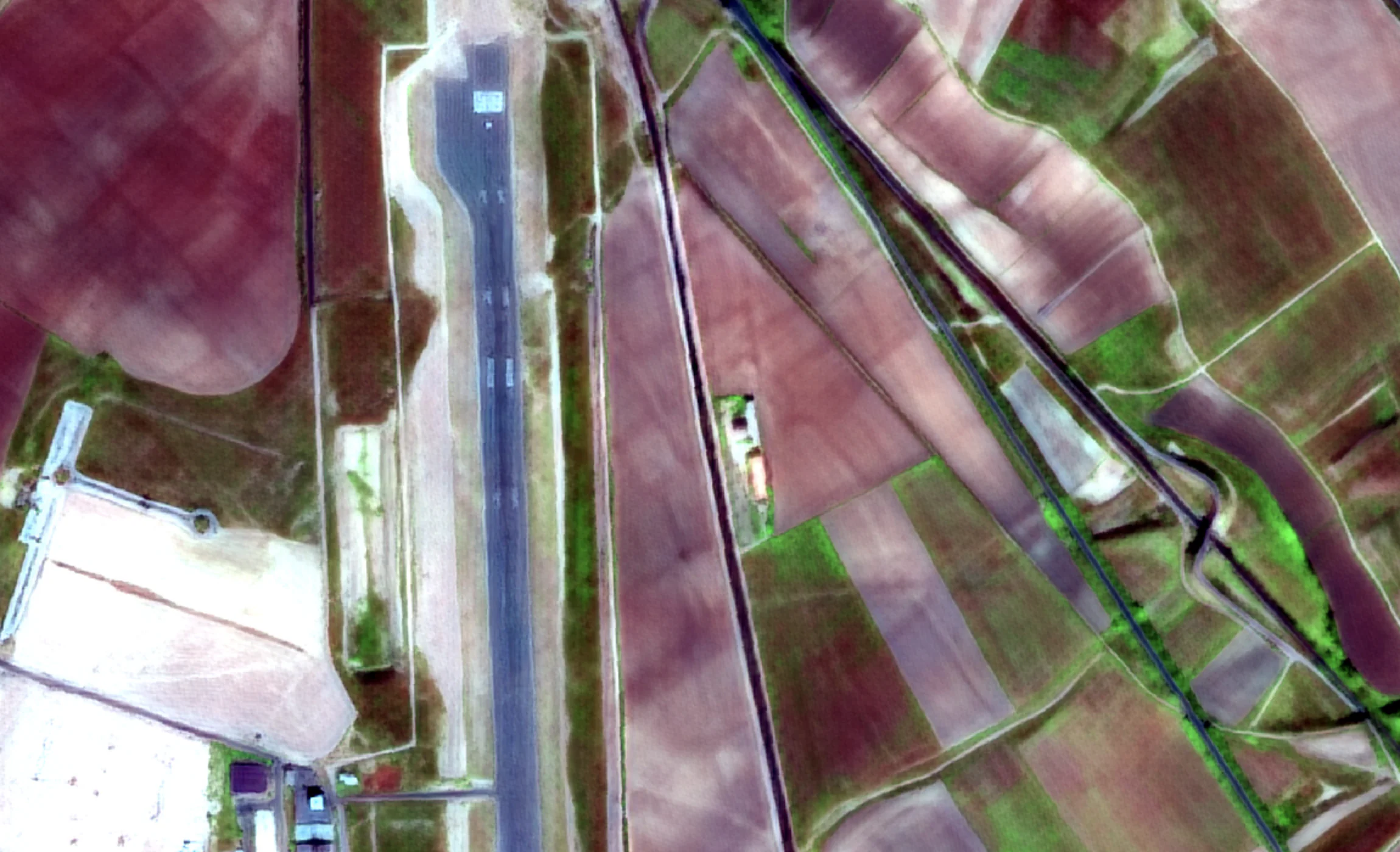
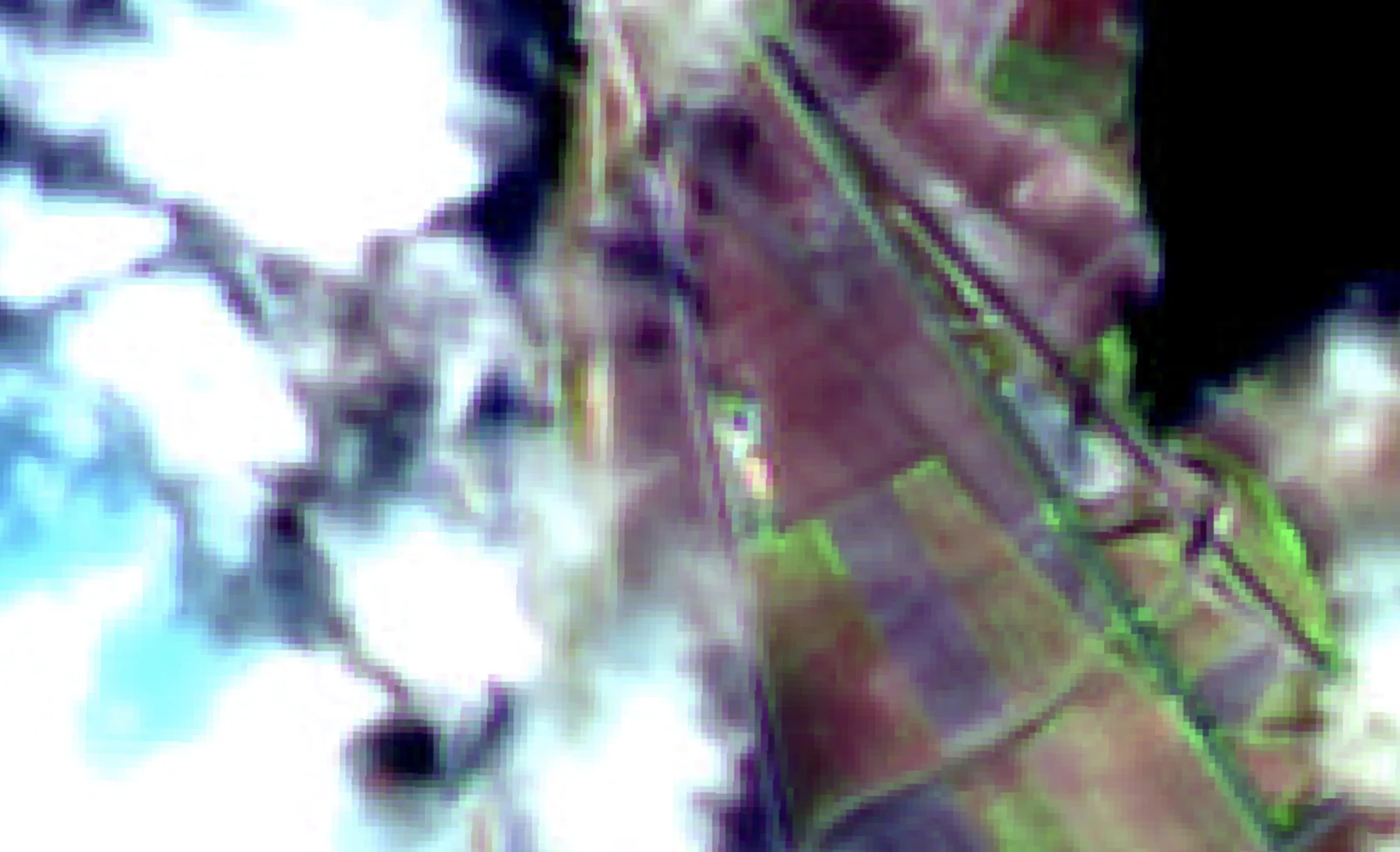
An airfield and its farmland at 10 m, and at 1 m
Sentinel-2 · 10 m
S2DR4 · 1 m
Sentinel-2 infra-red pseudo-colour imagery of the airfield and farmland at Teruel at 10 m, beside the GammaEarth S2DR4 output at 1 m, where the runway, the aircraft parked along it and parcel edges resolve.
Territory monitoring
Monitor the whole territory, not a sample of it
Cover everything, every cycle
Sentinel-2 images the whole planet every five days, for free, and any scene can be super-resolved to 1 m on demand — so a programme can process the entire jurisdiction each cycle instead of sampling where budget allows.
Verify claims against the ground
Subsidy declarations, permit conditions and contractor reports can each be checked against a dated 1 m record of what actually stood on the parcel — the same objective source for every case file.
Reach back before the complaint
Enforcement usually starts after the fact. The archive holds every Sentinel-2 scene since 2018, so the record of when a structure appeared or clearing began already exists by the time a case is opened.
Run it as a standing programme
Process the same administrative AOIs (areas of interest) on a fixed cadence through the API or Python SDK. For sovereign delivery, custom analytics or sensor programmes, GammaEarth works with government and space organisations directly.
Explore servicesCost and access
Territory-scale monitoring does not need a tasked-imagery budget
1 m is sufficient for parcel-scale administration
Super-resolved Sentinel-2 imagery at 1 m/px across all 10 spectral bands is sufficient for CAP (Common Agricultural Policy) parcel checks, illegal construction detection, cadastre alignment and disaster damage mapping — without commissioning an acquisition for any of it.
Independent of any tasking queue
There is no acquisition to commission and no operator's schedule to join: the input is the public Sentinel-2 archive, and processing to 1 m runs on demand for any date and AOI.
Priced per km², not per programme
Credits cost €2.00 each from a minimum of 100 credits (€200), and one credit processes one km² of Sentinel-2 imagery in standard regions — a 500 km² municipality is 500 credits (€1,000) per fully processed date. 20 free scenes through Google Colab let a desk evaluate the output before any procurement.
See pricingA baseline exists for every case
Any Sentinel-2A or Sentinel-2B scene from 2018 onwards can be super-resolved to 1 m/px, so a before-image exists for every enforcement case, disaster and boundary dispute — without anyone having ordered one in advance. Outputs are 16-bit GeoTIFF (COG ready — cloud-optimised GeoTIFF) records at 1 m/px GSD (ground sample distance) in UTM projection, and an already-processed date can be retrieved again free, years later.
Use cases
From subsidy checks to disaster response
CAP subsidy verification
Check declared land use and areas under the CAP (Common Agricultural Policy) against dated 1 m imagery of each claimed parcel — every parcel, every claim year, from the same source.
Illegal construction detection
New structures separate from the surrounding fabric at 1 m, and the five-day cadence with an archive back to 2018 dates when each one appeared — evidence for land-use enforcement.
Cadastre and land administration
Keep the cadastre aligned with the ground: 1 m imagery shows where boundaries, buildings and land use have diverged from the register, for exactly the districts under revision.
Environmental enforcement
Illegal logging, dumping and unlicensed extraction leave traces at scales a 10 m pixel averages away. At 1 m, on a five-day cycle, they resolve — across the whole protected area.
Disaster damage assessment
When flood, fire or storm strikes, the pre-event baseline is already in the archive: super-resolve the latest usable scene and the last one before the event, and map the difference.
Urban-growth statistics and planning
Measure how settlements actually grow — new streets, rooftops and sealed surfaces at 1 m — on a consistent five-day series that reaches back to 2018 for trend statistics.
FAQ
Public-sector monitoring questions
How do governments verify agricultural subsidies by satellite?
Under the CAP (Common Agricultural Policy) and similar schemes, declared parcels are checked against imagery rather than visited one by one — the approach EU paying agencies run as 'checks by monitoring' under their area monitoring systems. GammaEarth turns free Sentinel-2 imagery from 10 m to 1 m resolution across all 10 spectral bands, so each claim can be checked at parcel scale, with a fresh scene every five days.
Can satellite imagery detect illegal construction?
Yes. At 1 m, new buildings, extensions and access roads separate from their surroundings. Because any Sentinel-2A or Sentinel-2B scene from 2018 onwards can be super-resolved to 1 m/px, the archive also shows when a structure first appeared — the timeline an enforcement case needs.
Is super-resolved Sentinel-2 imagery good enough for a government monitoring programme?
Yes. Parcel boundaries, new structures and land-use change all resolve at 1 m/px across all 10 spectral bands — sufficient for subsidy checks, illegal construction detection and cadastre alignment. The economics hold at territory scale: with one credit per km² in standard regions at €2.00, a 250 km² district is 250 credits (€500) per fully processed date, and re-imaging arrives every five days at no input cost.
How current can a national land monitoring programme be?
The whole jurisdiction is re-imaged every five days — Sentinel-2's global revisit, at no input cost — and every new scene can be super-resolved to 1 m on demand. The S2DR4 model (Sentinel-2 Deep Resolution 4) takes out cloud, haze and shadow automatically, which carries that cadence through cloudy seasons.
What does it cost to monitor a whole district or region by satellite?
Credits cost €2.00 each with a minimum of 100 credits (€200), and one credit processes one km² of Sentinel-2 imagery in standard regions — a 500 km² district is 500 credits (€1,000) per fully processed date. Retrieving an already-processed date is free, and credits stay valid for 24 months.
Do we depend on a commercial satellite operator for this?
No. The input is the public Sentinel-2 archive — imagery that is free and re-acquired every five days — and GammaEarth processes it to 1 m on demand, so a programme runs independent of any operator's tasking queue. For sovereign delivery, custom analytics or sensor design, GammaEarth also works with government and space organisations directly. GammaEarth is an ESA Business Incubation Centre Switzerland incubatee.
Building a monitoring programme for a territory?
Tell us the jurisdiction, the checks you need to run and the cadence they require. We respond within one business day.