Industries
A 1 m basemap of anywhere, for any date since 2018
GIS and mapping teams pull a current 1 m basemap of any AOI (area of interest) on Earth, delivered as COG (cloud-optimised GeoTIFF) files through an API — no tasking, no sales call. The source is free Sentinel-2 imagery, super-resolved from 10 m to 1 m in all 10 spectral bands, from €2.00 per km² in standard regions.
See the difference
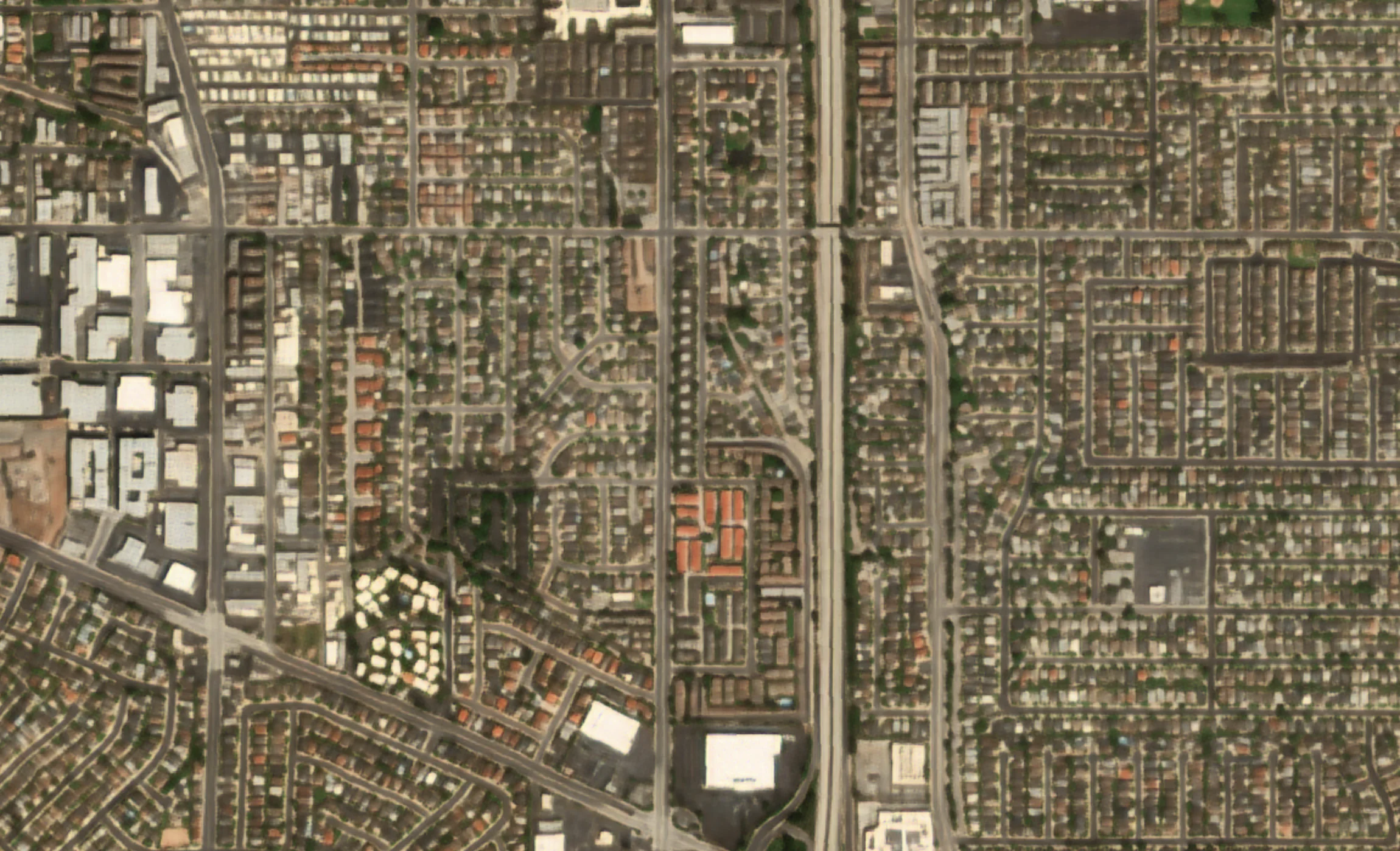
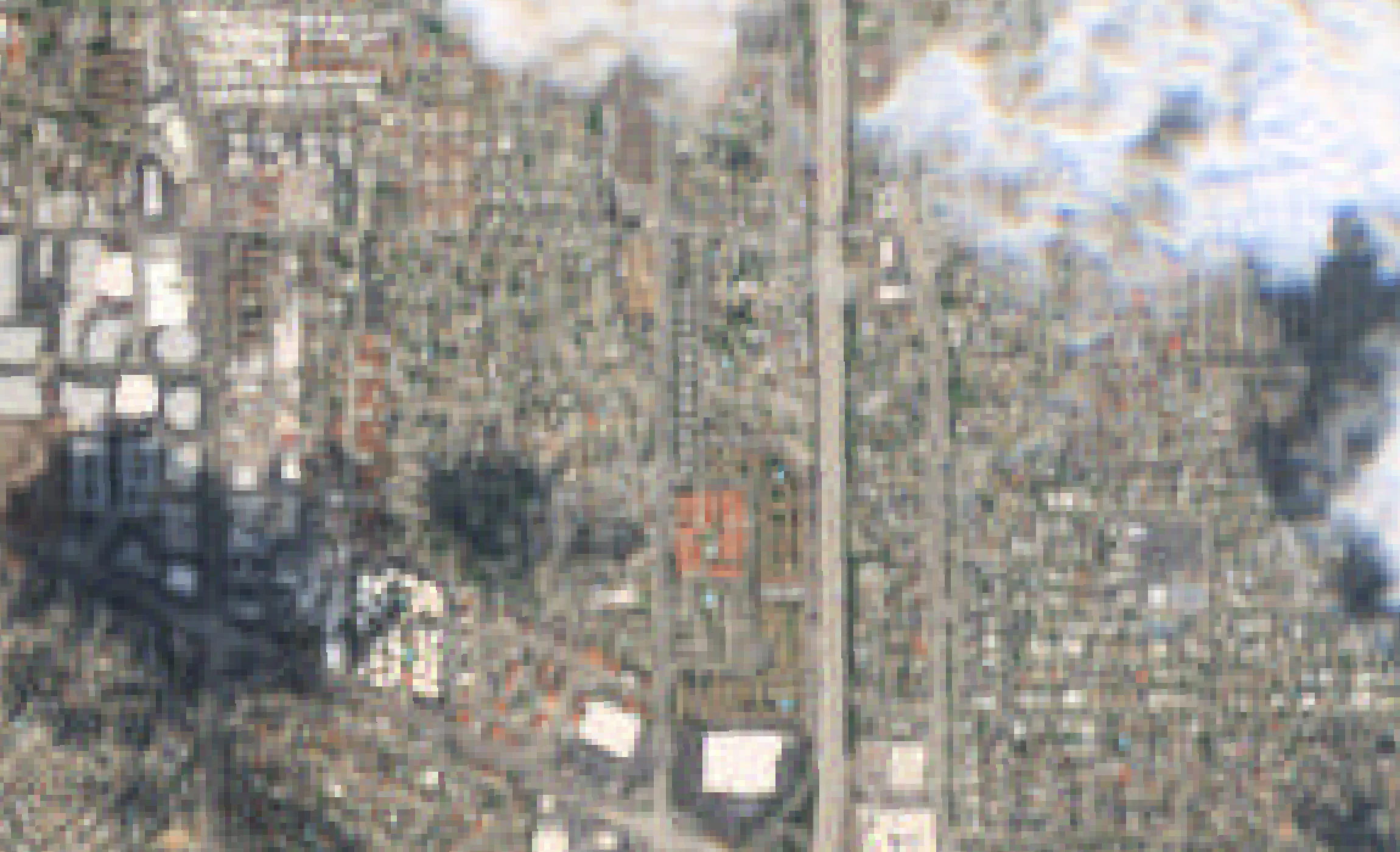
A city district at 10 m, and the same scene at 1 m
Sentinel-2 · 10 m
S2DR4 · 1 m
Sentinel-2 true-colour imagery of a residential district in Los Angeles at 10 m, beside the GammaEarth S2DR4 output at 1 m, where the street grid, the freeway corridor and single rooftops become legible.
In your GIS
From order to layer without leaving the pipeline
Drops straight into QGIS or ArcGIS
Outputs arrive at 1 m/px GSD (ground sample distance) in UTM projection as 16-bit GeoTIFF, COG ready — high-resolution imagery that loads in QGIS, ArcGIS or any raster pipeline as delivered.
Refresh a basemap on your own schedule
Sentinel-2 images the whole planet every five days, for free, so a project AOI can carry a current 1 m basemap rather than whatever a tile service last cached — pick the date, order the scene.
Digitise from 1 m, not 10 m
Feature extraction wants edges: at 1 m, roads, buildings and parcel boundaries resolve as digitisable geometry rather than mixed pixels, in all 10 spectral bands.
Script it end to end
Order programmatically through the satellite imagery API or Python SDK — AOI in, GeoTIFF out — and batch whole project portfolios instead of clicking through a portal.
Cost and access
A current basemap does not need an imagery procurement
1 m is sufficient to digitise from
Super-resolved from free Sentinel-2 input, the 1 m/px output carries all 10 spectral bands — sufficient for basemap refresh, road and building digitisation, and change mapping between any two dates. Edges resolve as geometry rather than mixed pixels, and no tasked acquisition is involved.
Small-area orders make sense
One credit processes one km² of Sentinel-2 imagery in standard regions, at €2.00 per credit. Credits start at 100 (€200) and stay valid for 24 months — a balance to draw on, so a 25 km² AOI costs 25 credits (€50) per processed date.
See pricingAny two dates, not just the next pass
Change mapping needs both ends of the interval. Any Sentinel-2A or Sentinel-2B scene from 2018 onwards can be super-resolved to 1 m/px, so both dates come from the archive — including the one nobody thought to order at the time.
Nothing to install before the first layer
20 free scenes through Google Colab run in the browser — inspect real output in your own GIS before buying credits. Production orders go through the API or Python SDK: AOI in, 16-bit GeoTIFF (COG ready) out, straight into QGIS, ArcGIS or a web map.
Use cases
From basemap refresh to bulk pipelines
Basemap refresh for project AOIs
Keep the backdrop current: order the latest scene over each project AOI — a high-resolution satellite basemap covering exactly the area the project does.
COG GeoTIFF into QGIS and ArcGIS
16-bit GeoTIFF, COG ready, at 1 m/px in UTM projection: drag it into QGIS or ArcGIS, or serve it to a web map straight from object storage.
Feature extraction and digitisation
Digitise roads, buildings and parcels from 1 m satellite imagery — by hand, or as training and inference input for extraction models.
Temporal change mapping
Super-resolve any two dates since 2018 over the same AOI and difference them — change mapping between the exact dates a project needs.
Site due diligence for remote AOIs
Check a site before travelling to it: its current state at 1 m plus its history back to 2018, for any location on Earth.
Programmatic bulk ordering
Drive orders from code with the Python SDK: loop over AOIs and dates, retrieve finished GeoTIFFs, and slot the step into an existing data pipeline.
FAQ
Mapping and GIS questions
Where can I get a high-resolution satellite basemap without tasking?
GammaEarth super-resolves free Sentinel-2 imagery from 10 m to 1 m across all 10 spectral bands, on demand, for any AOI (area of interest) on Earth. There is no tasking: any Sentinel-2A or Sentinel-2B scene from 2018 onwards can be processed to 1 m/px and used as a basemap.
Is super-resolved Sentinel-2 imagery good enough for GIS basemaps?
Yes. At 1 m/px, roads, buildings and parcel boundaries read as digitisable geometry, and all 10 spectral bands come with the basemap — backdrop, feature extraction and change mapping in one product. Keeping it current is a line item, not a procurement: refreshing a 40 km² project AOI is 40 credits (€80) per processed date in standard regions, from any Sentinel-2 scene since 2018.
What is the highest-resolution satellite imagery I can load into QGIS from free input?
GammaEarth starts from free Sentinel-2 input and super-resolves it from 10 m to 1 m across all 10 spectral bands. The processing itself is paid — €2.00 for each credit, one credit per processed km² in standard regions, with 20 free scenes through Google Colab to test — and the result is a 16-bit COG GeoTIFF that drags straight into QGIS.
How much does 1 m satellite imagery cost per km²?
One credit costs €2.00 and processes one km² of Sentinel-2 imagery in standard regions, so 1 m output is €2.00 per km² there, charged per processed date. The smallest purchase is 100 credits (€200); a balance can be spent over 24 months, and re-downloading an already-processed date costs nothing.
What format does the imagery come in for GIS software?
Deliverables are 16-bit GeoTIFF, COG ready (cloud-optimised GeoTIFF), at 1 m/px ground sample distance (GSD) in UTM projection — ten multispectral bands per order, along with derived RGB, NDVI (normalised difference vegetation index) and IRP (infra-red pseudo-colour) composites. They load directly in QGIS, ArcGIS and standard raster tooling.
Can I order historical satellite imagery of an area?
Yes. Any Sentinel-2A or Sentinel-2B scene from 2018 onwards can be super-resolved to 1 m/px — any AOI, any acquisition date in the archive, processed on demand rather than lifted from a pre-rendered mosaic.
Is there an API for ordering satellite imagery?
Yes. Orders run through a REST API or the Python SDK: submit an AOI and a date, receive 16-bit multiband GeoTIFFs at 1 m/px. A free tier of 20 scenes through Google Colab lets you test the output in your own GIS before buying credits.
Need a basemap the archive already holds?
Tell us your AOIs, the dates you need and the format your pipeline expects. We respond within one business day.